
Visualize Large Geospatial Datasets with Strato Maps
A powerful web mapping platform for exploring, analyzing, and sharing geospatial data at scale
Try Strato MapsA powerful web mapping platform for exploring, analyzing, and sharing geospatial data at scale
Try Strato MapsA powerful mapping and visualization tool for geospatial data.
High-performance vector tile server rapidly renders millions of features.
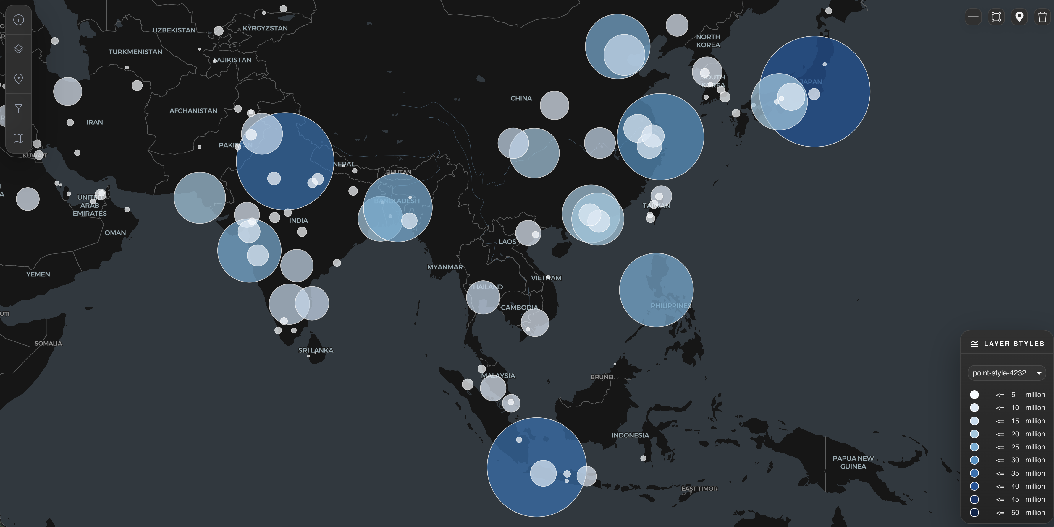
Visualize unlimited vector and raster layers.
Filter and edit spatial data in real-time. Click any feature to inspect and modify attributes.
Create public maps or private maps with granular permissions for authenticated users.
Self-hosted in your AWS account. Your data never leaves your infrastructure, giving you full control and full compliance.
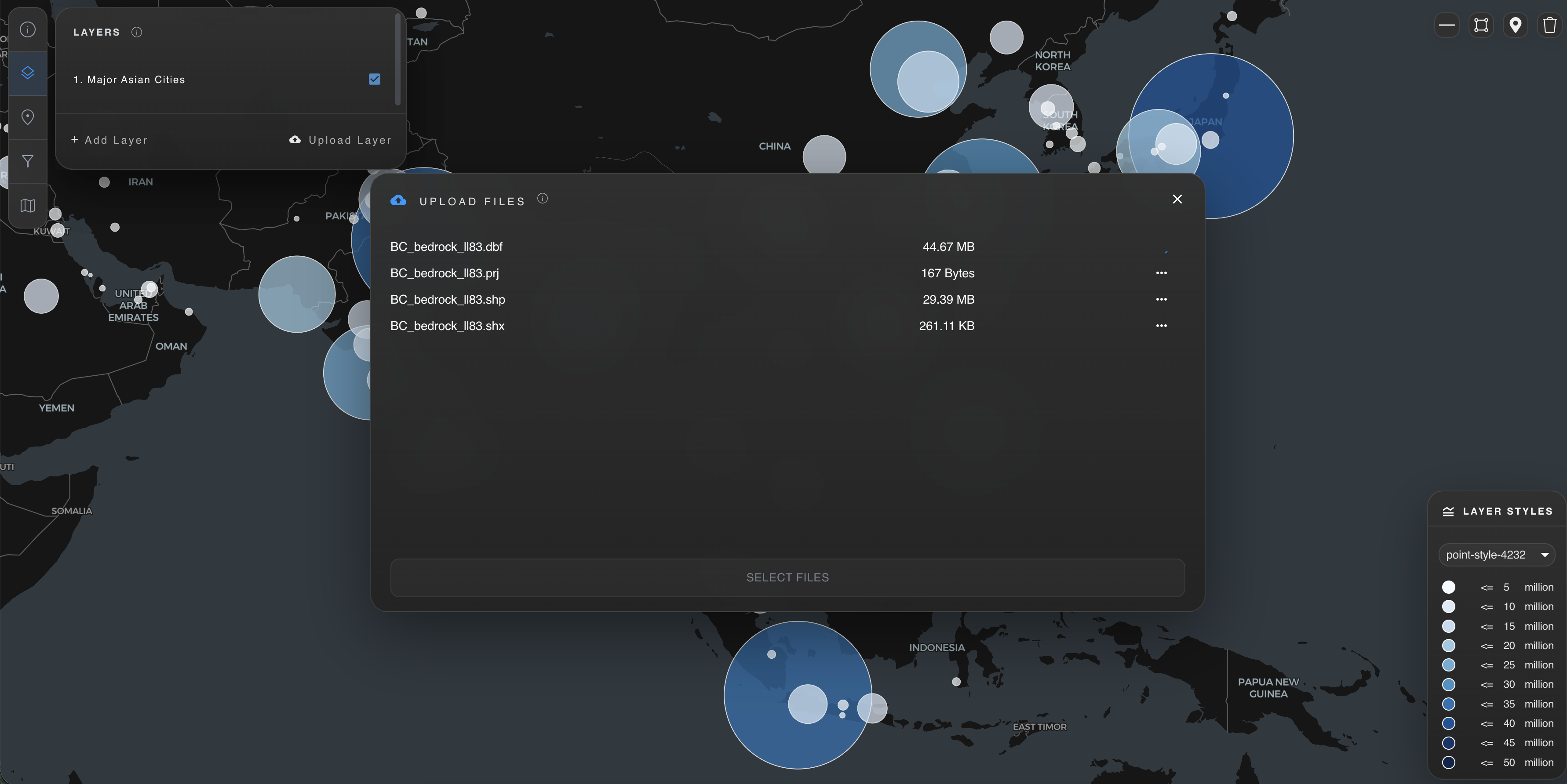
Integrate with your existing data pipelines or software to visualize geospatial datasets output to a designated S3 bucket.
Strato Maps helps organizations analyze and share large volumes of spatial data with maximum financial and operational efficiency.
Visualize natural resource datasets such as forest inventory or oil and gas producton assets.
Display real-time sensor data overlaid on satellite basemaps for watershed management.
Track infrastructure assets, utilities, and field data with attributable vector layers.
Collaborate with teammates to track busines concerns by updating spatial datasets on the fly
Our team will launch and configure the application components in your AWS account free of charge.
Point Strato Maps at your existing S3 buckets or geospatial databases. We support GeoTIFF, vector tiles, and most common spatial formats.
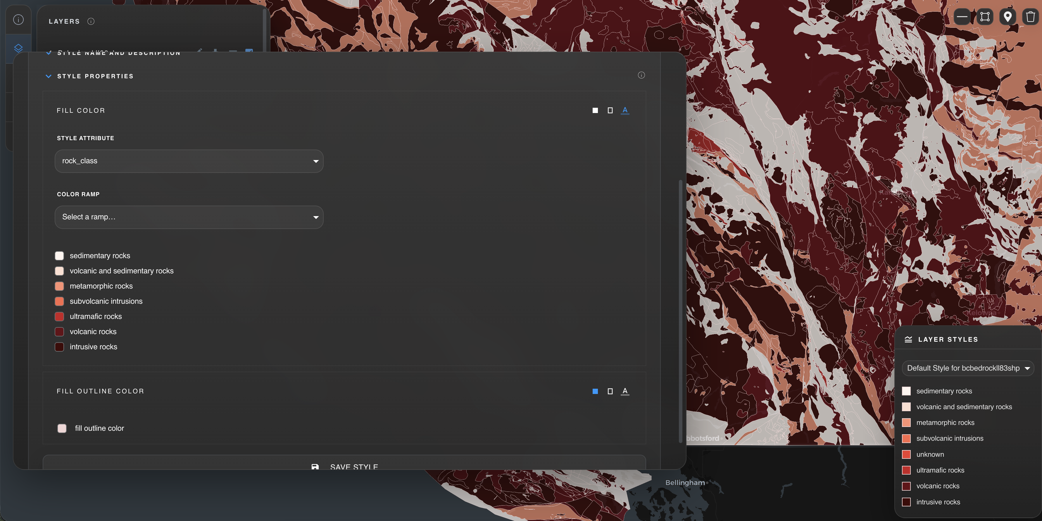
Define map layers, color ramps, labels, and interactivity using our visual style editor. Apply styles to vector and raster data without writing code.
Create unlimited maps, public or private with granular permissions for unlimited authenticated users.
Strato Maps supports all vector and raster formats supported by GDAL.
Yes. Maps can be configured as public or private, with unlimimted authenticated users for private maps.
Yes. The tile server is written in Rust and optimized for big data delivery via AWS S3 and CloudFront.
Yes. Strato Maps deploys directly into your existing AWS account and can read from any S3 bucket or compatible data source you already use.
Yes. The map interface is fully responsive and optimized for mobile browsers, with touch-friendly navigation and pinch-to-zoom support.